Twitter 6000km
Rethinking the 10 Tactics in «6,000km» project

A raiz de la clase Networked Social Movements: Media & Mobilization a la que estoy yendo, he escrito un post reflexionando sobre diferentes estrategias del uso de los medios. De paso nos sirve de reflexión para los siguientes pasos a dar dentro del proyecto 6.000km. Puedes ver el post en su lugar original.
—
The 10 tactics displayed in informationactivism.org –a project devoted to provide different ways for rights advocates to capture attention and communicate a cause– made me think about the tools that we have been using in the 6000km.org project. What methods have been useful to extend the message and empower others to act and spread the message?
About 6000km
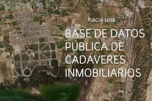
6,000 km is a documentation project devoted to research into cities’ metabolism, making visible certain hidden landscapes related to production, consume, and waste. Through a series of photographs, data an text, the project seeks to show specific spaces where waste is produced, handled and manipulated. Apart from the obvious ones —such as landfills and scrapyards— transport infrastructures and new models of urbanization are studied.
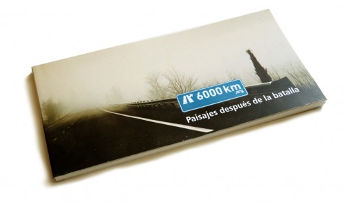
The project has focused its research in the effects of the real estate bubble in Spain. The last economic expansion period experienced in Spain has increased the use, and miss-use, of land. The research “landscapes after the battle” focuses on the post real estate boom, and its effects over the territory.
6000km is a project by the basurama.org collective.
The project used different media streams to display and gather information:
- map: meipi.org/6000km (open publish platform)
- locations: 6000km.org/localizaciones (curated web content)
- book: 6000km.org/libro (book version of “locations”: both in paper and online versions)
- exhibition: 6000km.org/exposicion (6-7ft panorama photos)
- blog: 6000km.org/blog
Now that the project is in low mantenaince mode after last year exhibition, let’s go through the 10 tactics explained in the video and see which have been used and which don’t. It is a good moment to think about the whole project and look for new ways of expanding it.
1. mobilise people.
The interactive map has been the main interactive platform to display and gather information about places to study. The open publishing web has allowed thirteen users to submit 87 entries. It must be mentioned that half of these users are part of the core group of the project. How these kind of platforms could be more inclusive and more widely used?
- To make open platform for civic engagement it might be useful to detach the project from the activist-artist-producer and make it a more white label-platform. For good or bad the promoting group, basurama.org, is the author of the project and that could make other activist to make their own projects. Projects like Open Street Map have managed to be seen as open publishing critical platforms.
- Projects must include tools for participation, but theyl also need promoting tools to be able to spread the word.
2. witness and record

The project is an open archive for all the situations that have a big impact in the territory. A panorama photo from the place, taken from a human perspective, shows directly how the location is. The photo goes along with a text and some data regarding the location.
We are thinking of doing a follow up of the places we have visited so far and have a series of photos of the places across time, as well as the evolution of the story of the place in a wiki style.
3. visualise your message
The meipi tool offers different approaches to visualize the locations posted on the map: by categories, an interactive mosaic of photos or the map. This sections list all the locations posted in the open platform. Then we decided to make our own curated archive in the 6000km.org site and a book. Does this proliferation of visualization help send the message or are it is “too much” information for the user?
[youtube http://www.youtube.com/watch?v=dEOEZD9AR9Q]
Anyway, we are thinking in possible new strategies to reach a broader audience by using more media tools in a more intensive way. Here some examples of collaborators: video (TOMOTO) and audio (eneko).

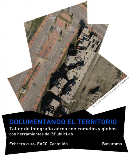
As the project right now is based in big format panorama photos, we are planning a series of videos animated them with different techniques and the extensive use of DIY aerial potography we have explored recently in Saugus Ash Landfill in Massachusetts.
4. amplify personal stories
We haven’t used personal stories, but in its way we try to reveal hidden stories of certain places.
5. just add humour
In the quotes that we use for every location we try to extract from high and low culture references:
From Shakira in Marina d’Or urbanization:
“Y ahora estoy aquí
queriendo convertir
los campos en ciudad
mezclando el cielo con el mar”
“Estoy aquí”. Pies Descalzos. Shakira. 1996
“-Por cierto, señor Sansón Carrasco, que tenemos nuestro merecido: con facilidad se piensa y se acomete una empresa, pero con dificultad las más veces se sale della. Don Quijote loco, nosotros cuerdos: él se va sano y riendo, vuesa merced queda molido y triste. Sepamos, pues, ahora, cuál es más loco: ¿el que lo es por no poder menos, o el que lo es por su voluntad?”
Segunda parte del ingenioso caballero don Quijote de la Mancha. Miguel de Cervantes Saavedra. 1615

With the IESO (Instituto por el Desarrollo de la Sostenibilidad), a kind of Yes Men Scientific group, we have also explored some humorous and media approaches to address similar topics: SostenibleTube.com. See 100% Sostenible video with english captions
6. manage your contacts
We have worked with very different kind of people (environmentalists, artists, experts) and organizations to make the research, but we’ve not maintained them. We are thinking of having an open email list to communicate among collaborators.
7. use complex data

The map is the more complex visualization. We preferred to have more specific-realted quality content, instead of a bulk-GIS approach to the locations. Still, we are looking for data bases that we could use. So far, our geolocations are available in a kml format: http://www.meipi.org/6000km.kml.php
We also contributed to Open Street Map (OSM) project by uploading information about the places we studied. A lot of the landfills we’ve studied so far, were not in google maps and not in OSM. Check here and play with the layers to see how the landfill in Saugus is only in OSM map.
8. use collective intelligence
The collective mapping tool use the crowd-sourced generated information to extend the research and facilitate the work of others.
9. let people ask the questions
All the sites that we have built have open comments and encourage people to publish their own content: collaborate + open call for collaborations.
10. investigate and expose
The whole project is an open end research. How can we make it more open?